
Jessen (Elster) topographic map
Interactive map
Click on the map to display elevation.
About this map
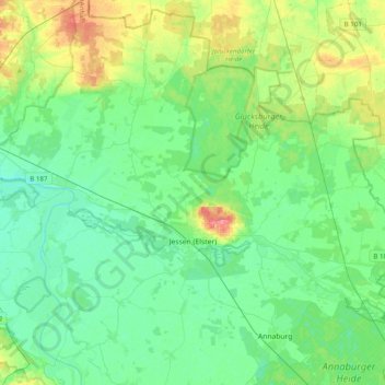
Name: Jessen (Elster) topographic map, elevation, terrain.
Location: Jessen (Elster), Wittenberg, Saxony-Anhalt, Germany (51.70769 12.77624 51.93939 13.17053)
Average elevation: 82 m
Minimum elevation: 64 m
Maximum elevation: 133 m