
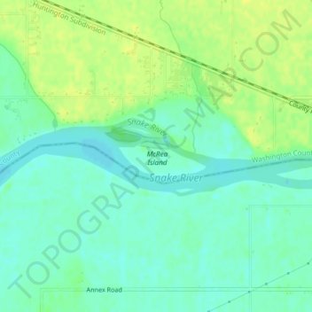
Snake River topographic map
Interactive map
Click on the map to display elevation.
About this map
Name: Snake River topographic map, elevation, terrain.
Average elevation: 644 m
Minimum elevation: 635 m
Maximum elevation: 653 m
Mountain ranges in the Snake watershed include the Teton Range, Bitterroot Range, Clearwater Mountains, Seven Devils Mountains, and the extreme northwestern end of the Wind River Range. Grand Teton is the highest point in the Snake River watershed, reaching 13,775 feet (4,199 m) in elevation. The elevation of the Snake River is 358 feet (109 m) when it joins the Columbia River.
Other topographic maps
Click on a map to view its topography, its elevation and its terrain.
Sawtooth National Forest
United States of America > Idaho > Rupert
Sawtooth National Forest, Sharon Court, Rupert, Minidoka County, Idaho, 83350, United States of America
Average elevation: 1,608 m
Genesee
United States of America > Idaho > Genesee
Genesee, Latah County, Idaho, 83832, United States of America
Average elevation: 824 m
Butte County
United States of America > Idaho
Butte County, Idaho, United States of America
Average elevation: 1,914 m
Chinese Peak
United States of America > Idaho
Chinese Peak, Bannock County, Idaho, United States of America
Average elevation: 1,830 m
Camas County
United States of America > Idaho
Camas County, Idaho, United States of America
Average elevation: 2,002 m
Eagle Rock
United States of America > Idaho
Eagle Rock, Idaho County, Idaho, United States of America
Average elevation: 1,164 m
Teton
United States of America > Idaho > Teton
Teton, Fremont County, Idaho, 83451, United States of America
Average elevation: 1,509 m
Springston
United States of America > Idaho
Springston, Kootenai County, Idaho, 83833, United States of America
Average elevation: 721 m