
Cotswold Hill topographic map
Interactive map
Click on the map to display elevation.
About this map
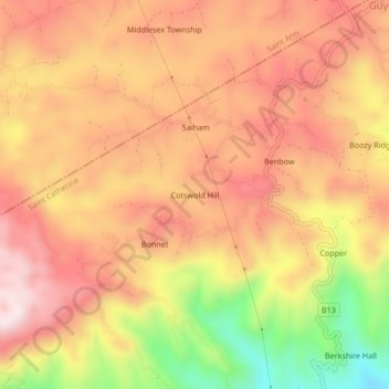
Name: Cotswold Hill topographic map, elevation, terrain.
Location: Cotswold Hill, Saint Catherine, Middlesex County, Jamaika (18.20764 -77.03794 18.24764 -76.99794)
Average elevation: 514 m
Minimum elevation: 203 m
Maximum elevation: 701 m