
Kazanlak topographic map
Interactive map
Click on the map to display elevation.
About this map
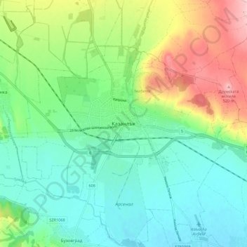
Name: Kazanlak topographic map, elevation, terrain.
Location: Kazanlak, Stara Zagora, 6100, Bulgaria (42.57913 25.35333 42.65913 25.43333)
Average elevation: 390 m
Minimum elevation: 328 m
Maximum elevation: 526 m