
Tlaxcalancingo (San Bernardino) topographic map
Interactive map
Click on the map to display elevation.
About this map
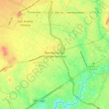
Name: Tlaxcalancingo (San Bernardino) topographic map, elevation, terrain.
Average elevation: 2,123 m
Minimum elevation: 2,065 m
Maximum elevation: 2,195 m
Other topographic maps
Click on a map to view its topography, its elevation and its terrain.
San Andrés Cholula
Mexico > Puebla > San Andrés Cholula
San Andrés Cholula, Puebla, Mexico
Average elevation: 2,136 m