
Lendalfoot topographic map
Interactive map
Click on the map to display elevation.
About this map
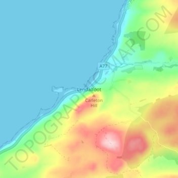
Name: Lendalfoot topographic map, elevation, terrain.
Location: Lendalfoot, South Ayrshire, Scotland, KA26 0JN, United Kingdom (55.14390 -4.96091 55.18390 -4.92091)
Average elevation: 62 m
Minimum elevation: 0 m
Maximum elevation: 214 m
Scotland trails, hiking, mountain biking, running and outdoor activities