
Thank you for supporting this site ❤️
Make a donation
Make a donation
Gear up for your next adventure:
As an Amazon Associate, this site earns from qualifying purchases at no extra cost to you.
Saint-Léonard topographic map
Click on the map to display elevation.
Thank you for supporting this site ❤️
Make a donation
Make a donation
Gear up for your next adventure:
As an Amazon Associate, this site earns from qualifying purchases at no extra cost to you.
About this map
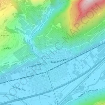
Name: Saint-Léonard topographic map, elevation, terrain.
Location: Saint-Léonard, Sierre, Valais/Wallis, 3960, Switzerland (46.24172 7.41110 46.27064 7.44764)
Average elevation: 620 m
Minimum elevation: 490 m
Maximum elevation: 1,197 m
Thank you for supporting this site ❤️
Make a donation
Make a donation
Gear up for your next adventure:
As an Amazon Associate, this site earns from qualifying purchases at no extra cost to you.