
Bay Roberts topographic map
Interactive map
Click on the map to display elevation.
About this map
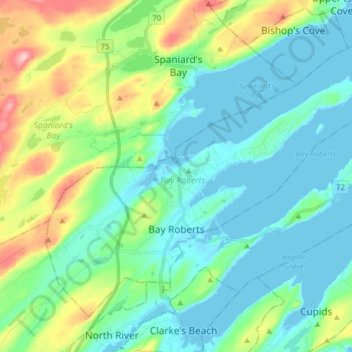
Name: Bay Roberts topographic map, elevation, terrain.
Average elevation: 44 m
Minimum elevation: -4 m
Maximum elevation: 215 m
Other topographic maps
Click on a map to view its topography, its elevation and its terrain.
Bishop's Beach
Canada > Newfoundland and Labrador > Bay Roberts
Bishop's Beach, Shoreline Heritage Walk, Bay Roberts, Newfoundland and Labrador, A0A 1W0, Canada
Average elevation: 7 m