
Kinta River topographic map
Interactive map
Click on the map to display elevation.
About this map
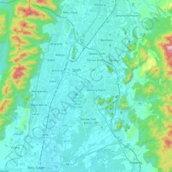
Name: Kinta River topographic map, elevation, terrain.
Location: Kinta River, Kepayang, Perak, 3000, Malaysia (4.46405 101.04415 4.69016 101.21840)
Average elevation: 146 m
Minimum elevation: 8 m
Maximum elevation: 915 m