
Hinterglemm topographic map
Interactive map
Click on the map to display elevation.
About this map
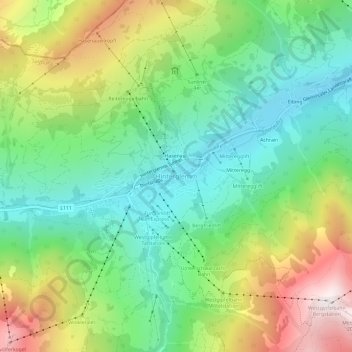
Name: Hinterglemm topographic map, elevation, terrain.
Location: Hinterglemm, Bezirk Zell am See, Salzburg, 5754, Austria (47.35896 12.57751 47.39896 12.61751)
Average elevation: 1,391 m
Minimum elevation: 1,002 m
Maximum elevation: 2,083 m