
Metherell topographic map
Interactive map
Click on the map to display elevation.
About this map
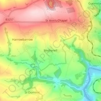
Name: Metherell topographic map, elevation, terrain.
Location: Metherell, Cornwall, England, PL17 8DB, United Kingdom (50.48519 -4.26475 50.52519 -4.22475)
Average elevation: 128 m
Minimum elevation: -3 m
Maximum elevation: 260 m