
Llandow topographic map
Interactive map
Click on the map to display elevation.
About this map
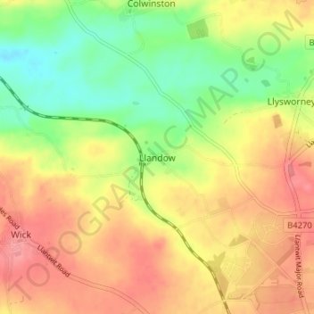
Name: Llandow topographic map, elevation, terrain.
Location: Llandow, Vale of Glamorgan, Wales, CF71 7NU, United Kingdom (51.42901 -3.54226 51.46901 -3.50226)
Average elevation: 69 m
Minimum elevation: 27 m
Maximum elevation: 104 m