
Taluk topographic map
Interactive map
Click on the map to display elevation.
About this map
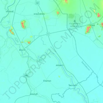
Name: Taluk topographic map, elevation, terrain.
Location: Taluk, Chai Nat Province, Thailand (15.02018 100.05934 15.34018 100.37934)
Average elevation: 20 m
Minimum elevation: 5 m
Maximum elevation: 253 m
Other topographic maps
Click on a map to view its topography, its elevation and its terrain.
Chao Phraya
Chao Phraya, Chai Nat Province, Thailand
Average elevation: 19 m
Sapphaya
Sapphaya, Hat Asa, Chai Nat Province, Thailand
Average elevation: 15 m