
Gold Hill topographic map
Interactive map
Click on the map to display elevation.
About this map
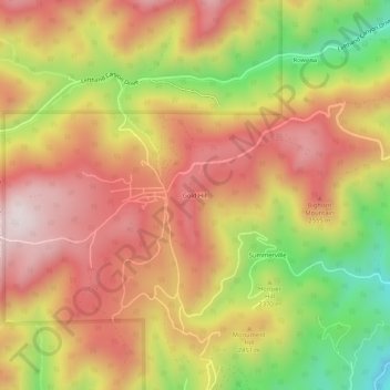
Name: Gold Hill topographic map, elevation, terrain.
Location: Gold Hill, Boulder County, Colorado, United States (40.04304 -105.42416 40.08304 -105.38416)
Average elevation: 2,410 m
Minimum elevation: 2,046 m
Maximum elevation: 2,675 m
Other topographic maps
Click on a map to view its topography, its elevation and its terrain.
Sunshine Canyon Drive
United States > Colorado > Boulder County > Gold Hill
Sunshine Canyon Drive, Gold Hill, Boulder County, Colorado, United States
Average elevation: 2,438 m