
Dexter Township topographic map
Interactive map
Click on the map to display elevation.
About this map
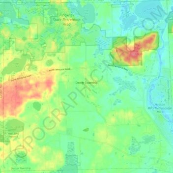
Name: Dexter Township topographic map, elevation, terrain.
Location: Dexter Township, Washtenaw County, Michigan, United States (42.33944 -84.01595 42.42521 -83.90033)
Average elevation: 278 m
Minimum elevation: 254 m
Maximum elevation: 324 m