
Enclave topographic map
Interactive map
Click on the map to display elevation.
About this map
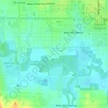
Name: Enclave topographic map, elevation, terrain.
Location: Enclave, Stillwater, Payne County, Oklahoma, United States (36.10548 -97.07935 36.10841 -97.07383)
Average elevation: 271 m
Minimum elevation: 262 m
Maximum elevation: 293 m
Other topographic maps
Click on a map to view its topography, its elevation and its terrain.
Stillwater
United States > Oklahoma > Payne County > Stillwater
Stillwater, Payne County, Oklahoma, 74077, United States
Average elevation: 295 m