
Middle Branch Shade River topographic map
Interactive map
Click on the map to display elevation.
About this map
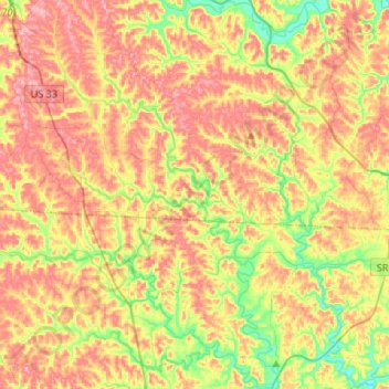
Name: Middle Branch Shade River topographic map, elevation, terrain.
Average elevation: 245 m
Minimum elevation: 176 m
Maximum elevation: 307 m
Other topographic maps
Click on a map to view its topography, its elevation and its terrain.
Millfield
United States > Ohio > Athens County > Millfield
Millfield, Athens County, Ohio, 45761, United States
Average elevation: 237 m
Glouster
United States > Ohio > Athens County
Glouster, Athens County, Ohio, United States
Average elevation: 235 m
Athens
United States > Ohio > Athens County
Athens, Athens County, Ohio, 45701, United States
Average elevation: 240 m