
Dayton topographic map
Interactive map
Click on the map to display elevation.
About this map
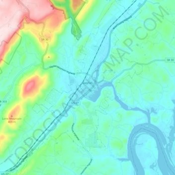
Name: Dayton topographic map, elevation, terrain.
Location: Dayton, Rhea County, Tennessee, 37321, United States (35.44644 -85.06163 35.53631 -84.97747)
Average elevation: 283 m
Minimum elevation: 202 m
Maximum elevation: 586 m
Other topographic maps
Click on a map to view its topography, its elevation and its terrain.
Mountain View
United States > Tennessee > Rhea County > Dayton > Mountain View
Mountain View, Dayton, Rhea County, Tennessee, 37321-6033, United States
Average elevation: 276 m