
Shiloh topographic map
Interactive map
Click on the map to display elevation.
About this map
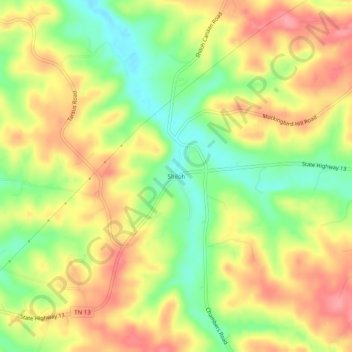
Name: Shiloh topographic map, elevation, terrain.
Location: Shiloh, Montgomery County, Tennessee, 37142, United States (36.34478 -87.52140 36.38478 -87.48140)
Average elevation: 173 m
Minimum elevation: 124 m
Maximum elevation: 215 m