
Clarksville topographic map
Interactive map
Click on the map to display elevation.
About this map
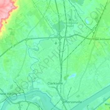
Name: Clarksville topographic map, elevation, terrain.
Location: Clarksville, Clark County, Indiana, United States (38.26805 -85.79721 38.38564 -85.74480)
Average elevation: 150 m
Minimum elevation: 111 m
Maximum elevation: 310 m
Other topographic maps
Click on a map to view its topography, its elevation and its terrain.
Sellersburg
United States > Indiana > Clark County
Sellersburg, Clark County, Indiana, 47172, United States
Average elevation: 149 m
Henryville
United States > Indiana > Clark County
Henryville, Clark County, Indiana, 47126, United States
Average elevation: 166 m
Charlestown
United States > Indiana > Clark County
Charlestown, Clark County, Indiana, 47111, United States
Average elevation: 170 m
Jeffersonville
United States > Indiana > Clark County
Jeffersonville, Clark County, Indiana, 47130, United States
Average elevation: 150 m