Geolocate

Suva topographic map

Interactive map

Click on the map to display elevation.

About this map

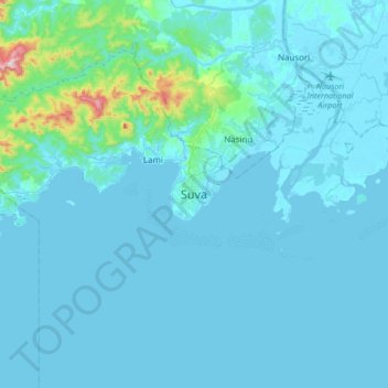
Name: Suva topographic map, elevation, terrain.

Location: Suva, Rewa, Central, Fiji (-18.30159 178.28217 -17.98159 178.60217)

Average elevation: 38 m

Minimum elevation: -2 m

Maximum elevation: 591 m

Other topographic maps

Click on a map to view its topography, its elevation and its terrain.

Laucala Island

Fiji > Central > Rewa > Suva

Laucala Island, Suva, Rewa, Central, Fiji

Average elevation: 1 m

Laucala

Fiji > Central > Rewa > Suva

Laucala, Suva, Rewa, Central, Fiji

Average elevation: 1 m