
Sunset Beach topographic map
Interactive map
Click on the map to display elevation.
About this map
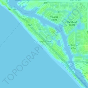
Name: Sunset Beach topographic map, elevation, terrain.
Average elevation: 2 m
Minimum elevation: -1 m
Maximum elevation: 11 m
Sunset Beach is a Huntington Beach beachfront community in Orange County, California. It was established on September 8, 1904 and developed as a result of the 1920 discovery of oil in the Huntington Beach Oil Field. The census-designated place of Sunset Beach and its population of 971 as of the 2010 census was annexed by Huntington Beach in 2011. The elevation is 5.3 feet above sea level and the community is stretched out along Pacific Coast Highway bracketed by the ocean and Huntington Harbour.