
Neve Zohar topographic map
Interactive map
Click on the map to display elevation.
About this map
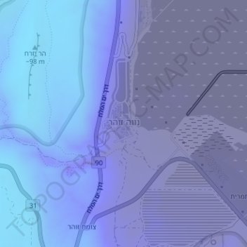
Name: Neve Zohar topographic map, elevation, terrain.
Average elevation: -327 m
Minimum elevation: -394 m
Maximum elevation: -76 m
Other topographic maps
Click on a map to view its topography, its elevation and its terrain.
Masada
Israel > South District > Tamar Regional Council
Masada, Ramp path, Tamar Regional Council, Beersheba Subdistrict, South District, Israel
Average elevation: -133 m
Ein Gedi
Israel > South District > Tamar Regional Council
Ein Gedi, Tamar Regional Council, Beersheba Subdistrict, South District, Israel
Average elevation: -266 m
HaMakhtesh HaKatan
Israel > South District > Tamar Regional Council
HaMakhtesh HaKatan, Malla Hazara, Tamar Regional Council, South District, no, Israel
Average elevation: 119 m