
Winwick topographic map
Interactive map
Click on the map to display elevation.
About this map
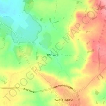
Name: Winwick topographic map, elevation, terrain.
Average elevation: 155 m
Minimum elevation: 110 m
Maximum elevation: 206 m
Other topographic maps
Click on a map to view its topography, its elevation and its terrain.
Winwick
United Kingdom > England > Winwick
Winwick, Warrington, North West England, England, WA2 8LG, United Kingdom
Average elevation: 21 m