
Geufron topographic map
Interactive map
Click on the map to display elevation.
About this map
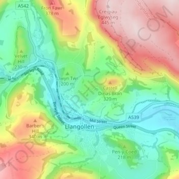
Name: Geufron topographic map, elevation, terrain.
Location: Geufron, Denbighshire, Wales, LL20 8DY, United Kingdom (52.95754 -3.18736 52.99754 -3.14736)
Average elevation: 217 m
Minimum elevation: 68 m
Maximum elevation: 447 m