
Oswestry topographic map
Interactive map
Click on the map to display elevation.
About this map
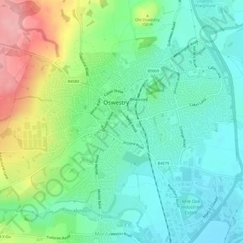
Name: Oswestry topographic map, elevation, terrain.
Location: Oswestry, Shropshire, West Midlands, England, United Kingdom (52.84246 -3.08141 52.87307 -3.02798)
Average elevation: 137 m
Minimum elevation: 96 m
Maximum elevation: 227 m