
Herzogenaurach topographic map
Interactive map
Click on the map to display elevation.
About this map
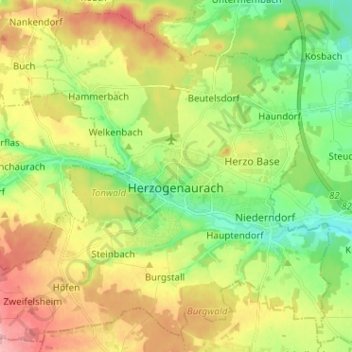
Name: Herzogenaurach topographic map, elevation, terrain.
Average elevation: 329 m
Minimum elevation: 281 m
Maximum elevation: 391 m
Other topographic maps
Click on a map to view its topography, its elevation and its terrain.
Oberreichenbach
Germany > Bavaria > Landkreis Erlangen-Höchstadt
Oberreichenbach, Aurachtal (VGem), Landkreis Erlangen-Höchstadt, Bavaria, 91097, Germany
Average elevation: 352 m
Röttenbach
Germany > Bavaria > Landkreis Erlangen-Höchstadt
Röttenbach, Landkreis Erlangen-Höchstadt, Bavaria, 91341, Germany
Average elevation: 315 m
Marloffstein
Germany > Bavaria > Landkreis Erlangen-Höchstadt
Marloffstein, Uttenreuth (VGem), Landkreis Erlangen-Höchstadt, Bavaria, Germany
Average elevation: 334 m