
Fareham topographic map
Interactive map
Click on the map to display elevation.
About this map
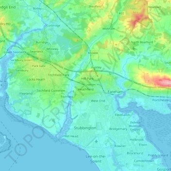
Name: Fareham topographic map, elevation, terrain.
Average elevation: 20 m
Minimum elevation: -5 m
Maximum elevation: 121 m
Other topographic maps
Click on a map to view its topography, its elevation and its terrain.
Swanwick
United Kingdom > England > Fareham > Swanwick
Swanwick, Fareham, Hampshire, South East England, England, SO31 1BW, United Kingdom
Average elevation: 25 m