
Charles Towne Landing topographic map
Interactive map
Click on the map to display elevation.
About this map
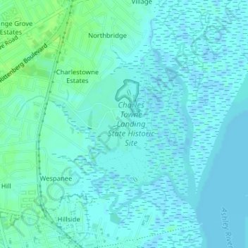
Name: Charles Towne Landing topographic map, elevation, terrain.
Average elevation: 3 m
Minimum elevation: -2 m
Maximum elevation: 10 m
Other topographic maps
Click on a map to view its topography, its elevation and its terrain.
Stono River
USA > South Carolina > Charleston
Stono River, Charleston, Charleston County, South Carolina, 29407, USA
Average elevation: 3 m
Plum Island
USA > South Carolina > Charleston
Plum Island, Charleston, Charleston County, South Carolina, 29402, USA
Average elevation: 3 m
Fogarty Creek
USA > South Carolina > Charleston
Fogarty Creek, Charleston, Berkeley County, South Carolina, USA
Average elevation: 5 m