
Kaçanik topographic map
Interactive map
Click on the map to display elevation.
About this map
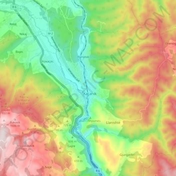
Name: Kaçanik topographic map, elevation, terrain.
Location: Kaçanik, Municipality of Kaçanik / Kačanik, 71000, Kosovo (42.19046 21.21690 42.27046 21.29690)
Average elevation: 732 m
Minimum elevation: 436 m
Maximum elevation: 1,092 m