
Río Gallegos topographic map
Interactive map
Click on the map to display elevation.
About this map
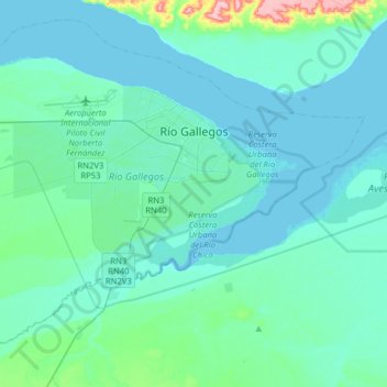
Name: Río Gallegos topographic map, elevation, terrain.
Location: Río Gallegos, Güer Aike, SC, Argentina (-51.71537 -69.40260 -51.57603 -69.13595)
Average elevation: 14 m
Minimum elevation: 0 m
Maximum elevation: 140 m
Other topographic maps
Click on a map to view its topography, its elevation and its terrain.
Casco Viejo
Casco Viejo, El Calafate, Lago Argentino, SC, Argentina
Average elevation: 205 m
San Martín
Argentina > SC > Río Gallegos
San Martín, Río Gallegos, Güer Aike, SC, Argentina
Average elevation: 14 m