

Salisbury topographic map
Click on the map to display elevation.
Salisbury
Bishop of Salisbury Hubert Walter was instrumental in the negotiations with Saladin during the Third Crusade, but he spent little time in his diocese prior to his elevation to archbishop of Canterbury. The brothers Herbert and Richard Poore succeeded him and began planning the relocation of the cathedral into the valley almost immediately. Their plans were approved by King Richard I but repeatedly delayed: Herbert was first forced into exile in Normandy in the 1190s by the hostility of his archbishop Walter and then again to Scotland in the 1210s owing to royal hostility following the papal interdiction against King John. The secular authorities were particularly incensed, according to tradition, owing to some of the clerics debauching the castellan's female relations. In the end, the clerics were refused permission to reenter the city walls following their rogations and processions. This caused Peter of Blois to describe the church as "a captive within the walls of the citadel like the ark of God in the profane house of Baal". He advocated
About this map
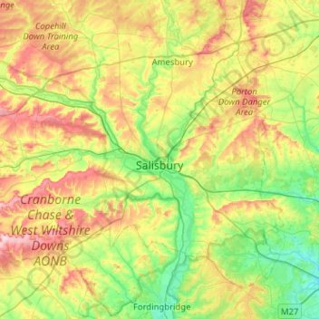
Name: Salisbury topographic map, elevation, terrain.
Average elevation: 96 m
Minimum elevation: 13 m
Maximum elevation: 241 m
England trails, hiking, mountain biking, running and outdoor activities