
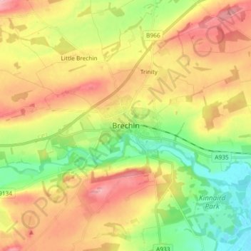
Brechin topographic map
Interactive map
Click on the map to display elevation.
About this map
Name: Brechin topographic map, elevation, terrain.
Location: Brechin, Angus, Scotland, DD9 6HH, United Kingdom (56.69152 -2.70002 56.77152 -2.62002)
Average elevation: 71 m
Minimum elevation: 6 m
Maximum elevation: 141 m
Angus trails, hiking, mountain biking, running and outdoor activities
Other topographic maps
Click on a map to view its topography, its elevation and its terrain.