
Calumpang topographic map
Interactive map
Click on the map to display elevation.
About this map
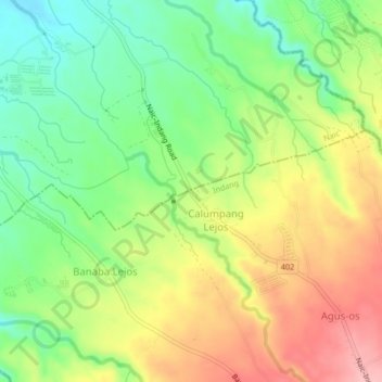
Name: Calumpang topographic map, elevation, terrain.
Location: Calumpang, Indang, Cavite, Calabarzon, 4122, Philippines (14.22003 120.82251 14.26003 120.86251)
Average elevation: 153 m
Minimum elevation: 92 m
Maximum elevation: 226 m