
River Severn topographic map
Interactive map
Click on the map to display elevation.
About this map
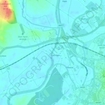
Name: River Severn topographic map, elevation, terrain.
Average elevation: 13 m
Minimum elevation: 6 m
Maximum elevation: 57 m
Other topographic maps
Click on a map to view its topography, its elevation and its terrain.
Robinswood Hill
United Kingdom > England > Gloucester
Robinswood Hill, Gloucester, Gloucestershire, South West England, England, GL4 6DX, United Kingdom
Average elevation: 57 m