
St. George's topographic map
Interactive map
Click on the map to display elevation.
About this map
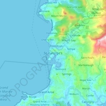
Name: St. George's topographic map, elevation, terrain.
Location: St. George's, Saint George, Grenada (12.01353 -61.79181 12.09353 -61.71181)
Average elevation: 72 m
Minimum elevation: 0 m
Maximum elevation: 509 m
Other topographic maps
Click on a map to view its topography, its elevation and its terrain.