
Rozendaal topographic map
Interactive map
Click on the map to display elevation.
About this map
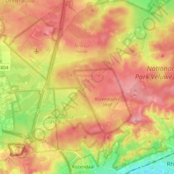
Name: Rozendaal topographic map, elevation, terrain.
Location: Rozendaal, Gelderland, Netherlands (51.99964 5.93710 52.07916 6.00899)
Average elevation: 66 m
Minimum elevation: 9 m
Maximum elevation: 106 m
Dutch topographic map of the municipality of Rozendaal, June 2015