
Industriequartier topographic map
Interactive map
Click on the map to display elevation.
About this map
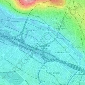
Name: Industriequartier topographic map, elevation, terrain.
Average elevation: 428 m
Minimum elevation: 398 m
Maximum elevation: 565 m
Other topographic maps
Click on a map to view its topography, its elevation and its terrain.
Kreis 10
Switzerland > Zurich > Zurich
Wipkingen, Kreis 10, Zurich, District Zurich, Zurich, 8037, Switzerland
Average elevation: 467 m
Kreis 7
Switzerland > Zurich > Zurich
Kreis 7, Zurich, District Zurich, Zurich, Switzerland
Average elevation: 532 m