
Hollandse IJssel topographic map
Interactive map
Click on the map to display elevation.
About this map
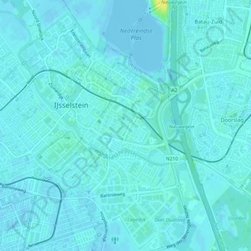
Name: Hollandse IJssel topographic map, elevation, terrain.
Average elevation: 3 m
Minimum elevation: -4 m
Maximum elevation: 20 m
Other topographic maps
Click on a map to view its topography, its elevation and its terrain.
Kromme IJssel
Nederland > Utrecht > IJsselstein
Kromme IJssel, IJsselstein, Utrecht, Nederland, 3432ND, Nederland
Average elevation: 3 m