
Wieruszów topographic map
Interactive map
Click on the map to display elevation.
About this map
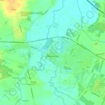
Name: Wieruszów topographic map, elevation, terrain.
Average elevation: 156 m
Minimum elevation: 145 m
Maximum elevation: 176 m
Other topographic maps
Click on a map to view its topography, its elevation and its terrain.
Wieruszów
Poland > Łódź Voivodeship > Wieruszów County > Wieruszów > Wieruszów
Wieruszów, gmina Wieruszów, Wieruszów County, Łódź Voivodeship, 98-400, Poland
Average elevation: 163 m