
Moeche topographic map
Interactive map
Click on the map to display elevation.
About this map
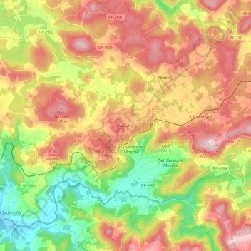
Name: Moeche topographic map, elevation, terrain.
Location: Moeche, Ferrol, A Coruña, Galicia, Spain (43.52297 -8.03637 43.60090 -7.91611)
Average elevation: 206 m
Minimum elevation: 31 m
Maximum elevation: 361 m
Other topographic maps
Click on a map to view its topography, its elevation and its terrain.
A Vacariza
Spain > Galicia > Ferrol > Narón
A Vacariza, Pedroso, Narón, Ferrol, A Coruña, Galicia, 15597, Spain
Average elevation: 135 m
A Ponte do Sur
Spain > Galicia > Ferrol > Moeche
A Ponte do Sur, San Xurxo de Moeche, Moeche, Ferrol, A Coruña, Galicia, 15563, Spain
Average elevation: 175 m
Vilacornelle
Spain > Galicia > Ferrol > Narón
Vilacornelle, O Val, Narón, Ferrol, A Coruña, Galicia, 15541, Spain
Average elevation: 80 m