
Tongham topographic map
Interactive map
Click on the map to display elevation.
About this map
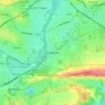
Name: Tongham topographic map, elevation, terrain.
Location: Tongham, Surrey, South East, England, GU10 1DR, United Kingdom (51.21484 -0.75126 51.25484 -0.71126)
Average elevation: 86 m
Minimum elevation: 58 m
Maximum elevation: 144 m