
Plateros topographic map
Interactive map
Click on the map to display elevation.
About this map
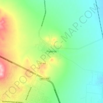
Name: Plateros topographic map, elevation, terrain.
Location: Plateros, Fresnillo, Zacatecas, México (23.18764 -102.87971 23.26764 -102.79971)
Average elevation: 2,170 m
Minimum elevation: 2,090 m
Maximum elevation: 2,333 m