
Khumbu Glacier topographic map
Interactive map
Click on the map to display elevation.
About this map
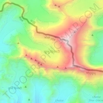
Name: Khumbu Glacier topographic map, elevation, terrain.
Average elevation: 6,296 m
Minimum elevation: 5,027 m
Maximum elevation: 8,849 m
The Khumbu Glacier is located in the Khumbu region of northeastern Nepal between Mount Everest and the Lhotse-Nuptse ridge. With elevations of 4,900 m (16,100 ft) at its terminus to 7,600 m (24,900 ft) at its source, it is the world's highest glacier. The Khumbu Glacier is followed for the final part of the trail to one of the Everest Base Camps. The start of the glacier is in the Western Cwm near Everest. The glacier has a large icefall, the Khumbu Icefall, at the west end of the lower Western Cwm. This icefall is the first major obstacle—and among the more dangerous—on the standard south col route to the Everest summit. It is also the largest glacier of Nepal.