
Halstenbek topographic map
Interactive map
Click on the map to display elevation.
About this map
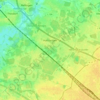
Name: Halstenbek topographic map, elevation, terrain.
Location: Halstenbek, Pinneberg, Schleswig-Holstein, 25469, Germany (53.60930 9.79887 53.64728 9.88499)
Average elevation: 16 m
Minimum elevation: 2 m
Maximum elevation: 25 m