
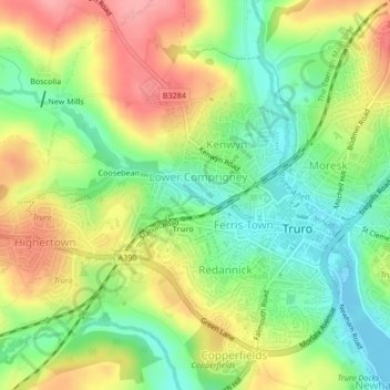
River Kenwyn topographic map
Interactive map
Click on the map to display elevation.
About this map
Name: River Kenwyn topographic map, elevation, terrain.
Average elevation: 46 m
Minimum elevation: -1 m
Maximum elevation: 100 m
Other topographic maps
Click on a map to view its topography, its elevation and its terrain.
Truro
United Kingdom > England > Truro
Truro, Cornwall, South West England, England, TR1 2RN, United Kingdom
Average elevation: 65 m
Truro River
United Kingdom > England > Truro
Truro River, Truro, Cornwall, South West England, England, TR1 1PT, United Kingdom
Average elevation: 34 m
Philleigh
United Kingdom > England > Truro
Philleigh, Cornwall, South West England, England, United Kingdom
Average elevation: 40 m