
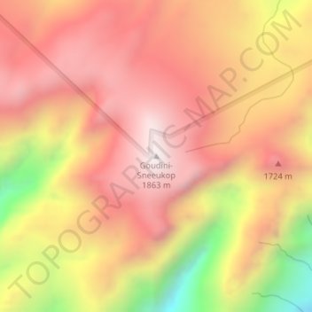
Goudini-Sneeukop topographic map
Interactive map
Click on the map to display elevation.
About this map
Name: Goudini-Sneeukop topographic map, elevation, terrain.
Average elevation: 1,508 m
Minimum elevation: 881 m
Maximum elevation: 1,862 m
Other topographic maps
Click on a map to view its topography, its elevation and its terrain.
Breede Valley Ward 7
RSA > Western Cape > Breede Valley Local Municipality
Breede Valley Ward 7, Breede Valley Local Municipality, Cape Winelands District Municipality, Western Cape, RSA
Average elevation: 258 m