
Ishaka topographic map
Interactive map
Click on the map to display elevation.
About this map
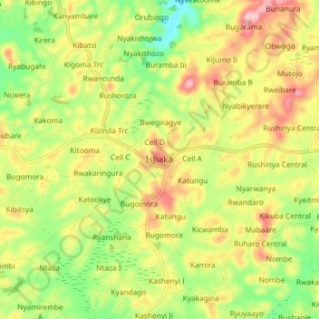
Name: Ishaka topographic map, elevation, terrain.
Location: Ishaka, Bushenyi, Western Region, Uganda (-0.58334 30.09723 -0.50334 30.17723)
Average elevation: 1,607 m
Minimum elevation: 1,507 m
Maximum elevation: 1,718 m
Other topographic maps
Click on a map to view its topography, its elevation and its terrain.