
Kota Damansara Community Forest Reserve topographic map
Interactive map
Click on the map to display elevation.
About this map
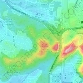
Name: Kota Damansara Community Forest Reserve topographic map, elevation, terrain.
Average elevation: 85 m
Minimum elevation: 36 m
Maximum elevation: 213 m
Other topographic maps
Click on a map to view its topography, its elevation and its terrain.
Prima Damansara
Malaysia > Selangor > PJ > Prima Damansara
Prima Damansara, PJ, Selangor, 47830, Malaysia
Average elevation: 79 m