
Miami River topographic map
Interactive map
Click on the map to display elevation.
About this map
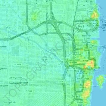
Name: Miami River topographic map, elevation, terrain.
Location: Miami River, Miami, Miami-Dade County, Florida, 33128, USA (25.76864 -80.22661 25.78635 -80.18355)
Average elevation: 9 m
Minimum elevation: -8 m
Maximum elevation: 36 m